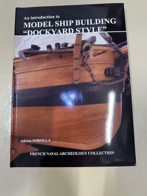
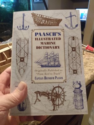
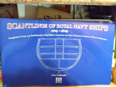
This reminds me of the classic Junks and Sampans of the Yangtse by G. R. G. Worcester (reprint: https://www.usni.org/press/books/junks-and-sampans-yangtze)
-
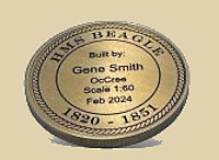
Win a Free Custom Engraved Brass Coin!!!
As a way to introduce our brass coins to the community, we will raffle off a free coin during the month of August. Follow link ABOVE for instructions for entering.
-
PRE-ORDER SHIPS IN SCALE TODAY!
The beloved Ships in Scale Magazine is back and charting a new course for 2026!
Discover new skills, new techniques, and new inspirations in every issue.
NOTE THAT OUR FIRST ISSUE WILL BE JAN/FEB 2026
You are using an out of date browser. It may not display this or other websites correctly.
You should upgrade or use an alternative browser.
You should upgrade or use an alternative browser.
New on your bookshelf ..... show it here
- Thread starter Uwek
- Start date
- Watchers 96
-
- Tags
- your new books
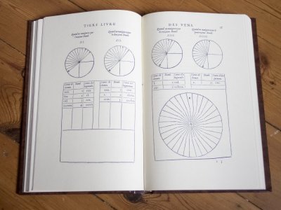
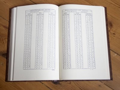
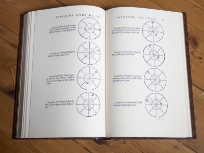
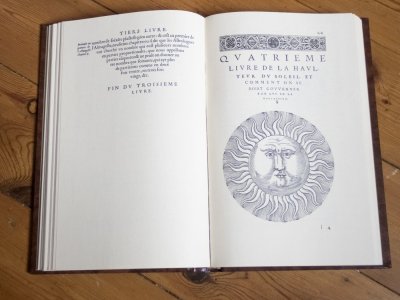
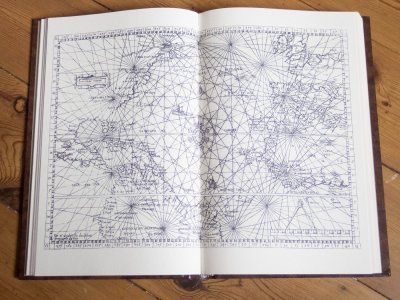
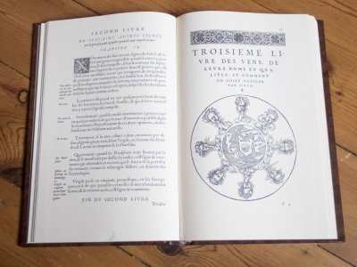
This is how they found their way on the high seas mid 16th century.
L'Art de Naviguer. Facsimile of the 1554 French edition of Pedro de Medina's 'Arte de Navegar'.
Published about 1980 by De Boer Maritieme Handboeken, Netherlands, limited to 1000 copies, printed on antique laid paper. ISBN 9782852310087
From Wikipedia:
Arte de navegar ("The Art of Navigation", 1545) was the first work published in Spain dealing exclusively with navigational techniques (Martín Fernández de Enciso's Suma de Geographia, 1519, which gave ample geographical information already contained solar declination tables with explanations and the corrections for finding the latitude by measuring the height of Polaris).
The book was internationally disseminated and quickly translated into several European languages: it was translated into French fifteen times between 1554 and 1663, five times into Dutch (1580-1598), three times into Italian (1554-1609) and twice into English. This work contributed considerably to the development of navigation on the high seas.


Last edited:
Great resource !Bought a used copy this week. Enjoyed looking through it yesterday. Now to find some time to read it, little by little that is.View attachment 524251
Bought a used copy this week. Enjoyed looking through it yesterday. Now to find some time to read it, little by little that is.
Excellent choice! An essential reference work for anybody interested in period English warships and really valuable for anybody building any sailing ship model, too. It took him ten years to write it. That said, I doubt anybody has ever sat and read it cover to cover, so don't make yourself crazy. Just skim it and read what's of interest as you go, because even if you read the whole thing, it isn't possible for anybody to remember everything that's in it! You'll be lucky to scratch your head someday thinking "I know I've got the answer in a book here somewhere, but damned if I can remember which one." Then grab Lees and check the index. Odds are it'll be in there.
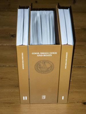
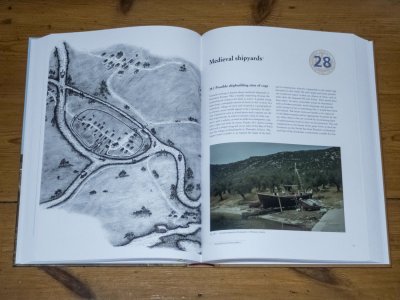
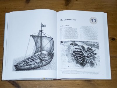
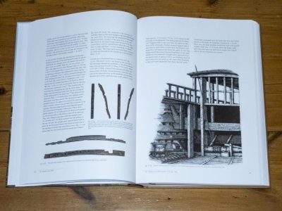
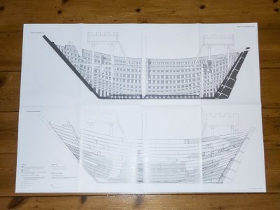
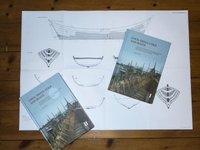
Just my lucky day. Found this awesome publication discounted from € 249,50 to € 25,00, new in seal. Comes with 35 A1 plans and 35 A2 plans.
The text below is from the publisher's website, the photo's are mine.
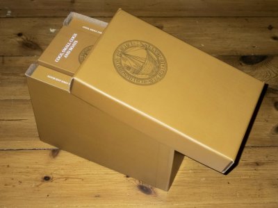
Cogs, small cogs and boats , Vlierman, K.
Hardcover, 2 parts, 1000 pp. With 70 A1 and A2 drawings, all in luxe casette. SPA uitgevers 2021
From the thirteenth to the fifteenth century an important part of the economy in north western Europe was based on trade in the Hanseatic League. The main means of transport consisted of ships, mainly cogs. The importance of this type of ship was already apparent from medieval documents, miniatures and other sources.
One of the world's largest collections of medieval shipwrecks emerged after the Second World War during the partial reclamation of the IJsselmeer lake (the former Zuiderzee inlet) in the Netherlands, where three polders were created from 1942 onwards. During these works, hundreds of shipwrecks from the period between 1250 and 1900 were discovered, about twenty of these being cogs.
Maritime archaeologist Karel Vlierman has excavated shipwrecks all his working life. He dedicated himself to the research of these ships, including two cogs found at Doel near Antwerp and the recently uncovered cog from the river IJssel near Kampen. His research of more than twenty years has resulted in a monograph of over 950 richly illustrated pages, together with some 70 large technical drawings of all the investigated cogs and their reconstructions.
The monograph and the folder with the 70 technical drawings - in A1 and A2 format - together come in a fine slipcase.
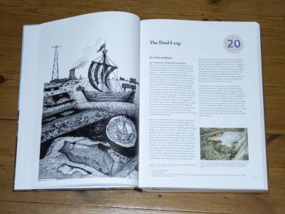
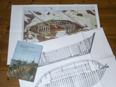
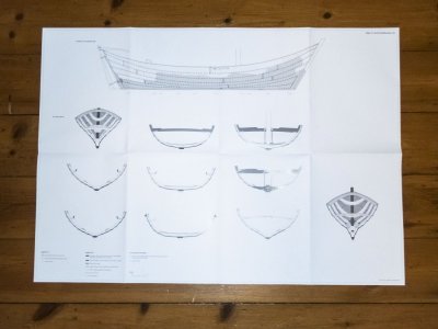
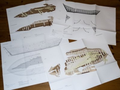


- Joined
- Oct 23, 2018
- Messages
- 886
- Points
- 403

This book about cogs I didn't know. Thanks for sharing.
And now I have another book which I like to have for my collection.

Hartelijk bedankt.
And now I have another book which I like to have for my collection.

Hartelijk bedankt.
That is a real bargain for that interesting set of books and drawings. Do you plan to build a cog or boat?Just my lucky day. Found this awesome publication discounted from € 249,50 to € 25,00, new in seal. Comes with 35 A1 plans and 35 A2 plans.
Last edited:
- Joined
- Apr 12, 2025
- Messages
- 290
- Points
- 158

Nice find, indeed! Congrats!Just my lucky day. Found this awesome publication discounted from € 249,50 to € 25,00, new in seal. Comes with 35 A1 plans and 35 A2 plans.
The text below is from the publisher's website, the photo's are mine.
No, just a matter of general interest. And I love books, especially those with maps and plans.That is a real bargain for that interesting set of books and drawings. Do you plan to build a cog or boat?
You are a lucky guy or a perpicace web searcher. However, could you Say where you Found IT?
- Joined
- Apr 12, 2025
- Messages
- 290
- Points
- 158

If you're speaking to 'me'... Seawatch books has them. If you 'weren't' addressing me... go to Seawatch and buy this book anyway!You are a lucky guy or a perpicace web searcher. However, could you Say where you Found IT?
Yes Mr. Thomas, Il speak about you. Thanks for the infos.
I just went to their website and didn't see this set for sale.Just my lucky day. Found this awesome publication discounted from € 249,50 to € 25,00, new in seal. Comes with 35 A1 plans and 35 A2 plans.
The text below is from the publisher's website, the photo's are mine.
Cogs, small cogs and boats , Vlierman, K.
Hardcover, 2 parts, 1000 pp. With 70 A1 and A2 drawings, all in luxe casette. SPA uitgevers 2021
From the thirteenth to the fifteenth century an important part of the economy in north western Europe was based on trade in the Hanseatic League. The main means of transport consisted of ships, mainly cogs. The importance of this type of ship was already apparent from medieval documents, miniatures and other sources.
One of the world's largest collections of medieval shipwrecks emerged after the Second World War during the partial reclamation of the IJsselmeer lake (the former Zuiderzee inlet) in the Netherlands, where three polders were created from 1942 onwards. During these works, hundreds of shipwrecks from the period between 1250 and 1900 were discovered, about twenty of these being cogs.
Maritime archaeologist Karel Vlierman has excavated shipwrecks all his working life. He dedicated himself to the research of these ships, including two cogs found at Doel near Antwerp and the recently uncovered cog from the river IJssel near Kampen. His research of more than twenty years has resulted in a monograph of over 950 richly illustrated pages, together with some 70 large technical drawings of all the investigated cogs and their reconstructions.
The monograph and the folder with the 70 technical drawings - in A1 and A2 format - together come in a fine slipcase.
View attachment 527438
View attachment 527439
View attachment 527440
View attachment 527441
Hello,
Could you please provide a link?
Thanks!
IT is not on Seawatchbook, but could be interesting to know where Hatteras bought them. We should not ne confuse between Hatteras and MThomas pourchases.I just went to their website and didn't see this set for sale.
Could you please provide a link?
Thanks!
Last edited:
Hello @Allegheny ,I just went to their website and didn't see this set for sale.
Could you please provide a link?
Thanks!
I did not purchase the book from the publisher. I ordered it from Boekhandel ABC in Deventer (Netherlands) through the Dutch antiquarian books website boekwinkeltjes.nl. I just saw to my surprise they have still more copies available for the same ridiculous price. Below is the link.

Boekwinkeltjes
Op boekwinkeltjes.nl koopt en verkoopt u uw tweedehands boeken. Zo'n 10.000 antiquaren, boekhandelaren en particulieren zijn u al voorgegaan. Samen zijn ze goed voor een aanbod van 7 miljoen titels.
- Joined
- Jun 22, 2025
- Messages
- 33
- Points
- 48

Just arrived yesterday! I mentioned this book in my build log of the Airfix Classic Ships 1:168 scale Royal Sovereign (https://shipsofscale.com/sosforums/...hips-1-168-scale-royal-sovereign-build.17201/). It is an amazing addition to my growing library concerning ships that I am interested in building to include HMAV Bounty, USS Constitution, Cutter Lady Nelson, USS Fletcher, and the USS The Sullivans.
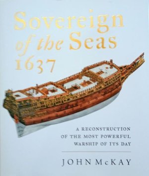
Regarding this hardback addition, it is a gold mine of detailed information for the modeler to include color prints of the hull exterior and extensive detailed plates that cover everything from the ship's framing, internal layouts, armament, masts, rigging, and sails. Just about every aspect of the ship you can think of is addressed by the author. Published by Seaforth Publishing, South Yorkshire, Great Britain in 2020. An incredible achievement.
Regarding this hardback addition, it is a gold mine of detailed information for the modeler to include color prints of the hull exterior and extensive detailed plates that cover everything from the ship's framing, internal layouts, armament, masts, rigging, and sails. Just about every aspect of the ship you can think of is addressed by the author. Published by Seaforth Publishing, South Yorkshire, Great Britain in 2020. An incredible achievement.

Last edited:
Someone (sorry, I forget who. Maybe it was Paul @dockattner ) mentioned this book so I ordered it. Glad I did, it looks to be great!
